The PCB wiki has now been archived and is read-only. |
Difference between revisions of "Freehold, Bayonne"
(Added Freehold, Bayonne into the 'Creative 1.8 Towns' category.) |
|||
| (20 intermediate revisions by 2 users not shown) | |||
| Line 1: | Line 1: | ||
{{infobox Town | {{infobox Town | ||
| name = Freehold | | name = Freehold, Bayonne | ||
| founder = BroodingSet | | founder = BroodingSet (now Poctivy_Ani) | ||
}} | | screenshot = Skyline_of_Freehold.jpeg | ||
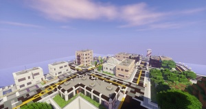
| caption = Skyline of Freehold | |||
|Established = July 9, 2015|Warp = /freehold|Style = Modern|screenshot_alt = |map = }} | |||
'''Freehold''' | '''Freehold''' was a city in the [[Bayonne|Republic of Bayonne]]. It is the only community that is a part of Bayonne, making it the capital. Assessing by the counting of the amount of residential buildings that are either houses or apartments located within the city, Freehold has an estimated max population of 180. | ||
Established on July 9, 2015, Freehold is one of the oldest cities in the [[Creative 1.8 Map]], or what is also known as the Sixth Creative World. The namesake of Freehold, Bayonne comes from the communities of Freehold Borough<ref>http://www.freeholdboroughnj.gov/</ref><ref>https://en.wikipedia.org/wiki/Freehold_Borough,_New_Jersey</ref> and Bayonne, New Jersey<ref>http://www.bayonnenj.org/</ref><ref>https://en.wikipedia.org/wiki/Bayonne,_New_Jersey</ref>. Freehold consists of four districts, the Capital District, Downtown Freehold, Dover, and Freehold International Airport. The namesake of the district of Dover was derived from Dover, Delaware<ref>https://www.cityofdover.com/</ref><ref>https://en.wikipedia.org/wiki/Dover,_Delaware</ref>. | |||
== History == | == History == | ||
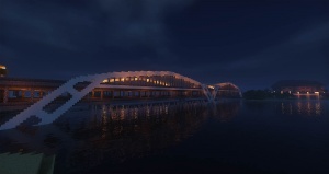
Freehold was founded by BroodingSet (now Poctivy_Ani). Shortly after its founding, the Capital district was created, along with the planned three districts. Juneau Corp. is headquartered in this district, and was built during the same month of the community's establishment. In August 2015, construction began on the eastern fringes of the present day downtown district. Some buildings built at that time was the city's library and a commercial building. On August 21, the Morgan Trust Center was built. It was then the tallest building in Freehold, until it was surpassed by the Capital Building of Bayonne on January 18, 2016. In the late summer of 2015, Freehold plotted it's first park, Clatsop Park, named after Fort Clatsop<ref>https://en.wikipedia.org/wiki/Fort_Clatsop</ref>, the endpoint of the Lewis and Clark Expedition<ref>https://en.wikipedia.org/wiki/Lewis_and_Clark_Expedition</ref>. On September 7, 2015, Freehold received a warp and on November 14, Freehold's Bayonne Bridge, based off its real-life counterpart<ref>http://www.panynj.gov/bridges-tunnels/bayonne-bridge.html</ref><ref>https://en.wikipedia.org/wiki/Bayonne_Bridge</ref>, was completed, connecting the city and the peninsula it was built within to the mainland. Before there was any connection, the plains were disconnected by the [[Alga Sea]] and the nearby mountains. | |||
Freehold was | |||
In early 2016, construction was slow for both | In early 2016, construction was slow for both the city's downtown district and the terminal of the airport. The airport then only had a runway and a control tower. February saw the development of Freehold's suburban district, Dover. Throughout the spring and summer of the same year, construction resumed in Downtown and the last building within the district, Freehold Regional Hospital, was completed on August 31. The exterior of the airport's terminal was completed on July 20. Afterwards, the last additions surrounding the terminal included a parking lot surrounded by a road loop. In September, blueprints showing a complete airport for the city was created. However, from then on, the airport was left on hold; thus its planned two runways were ultimately left defunct. | ||
== Geography == | |||
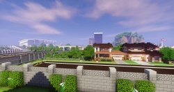
[[File:Capital_District.jpeg|The Capital District, the location of the city's founding, is known for its breathtaking views of the nearby Alga Sea.|thumbnail]] | |||
Freehold was founded on a peninsula surrounded by the [[Alga Sea]]. It's northern border is defined by a 5 meter (16.4 ft.) tall wall, and a line of buoys from the wall to the opposite shore. The eastern end of the city is defined by the Alga Sea, south of the line of buoys. The western border is formed by the highway connecting Freehold to [[Budapest]], while the southern fence stretches from the city's Olympic Stadium, to the Alga Sea. Freehold does not clearly border any city aside for the community of Minneapolis to the south, and possibly Rhodes, [[Frank Island]], [[Kistelek]] and [[Budapest]] to the north. | |||
== Points of Interest == | |||
[[File:Bayonne_Bridge.jpeg|The Bayonne Bridge connects Freehold to the landmass south of the peninsula it was built upon.|thumbnail]]All locations are listed with their date of completion, its location according to the street they face or general area's name and the district they are within (Locations within no district are still within Freehold): | |||
{| class="wikitable sortable" | |||
|- | |||
! Point of Interest !! Date of Completion !! Location !! District | |||
|- | |||
| Freehold City Hall || July 9, 2015 || Freehold Avenue || Capital | |||
|- | |||
| Freehold Lighthouse || August 1, 2015 || Carroll Ave. / Bojack St. || Capital | |||
|- | |||
| Rio Grande Hotel || August 10, 2015 || Freehold Avenue || Capital | |||
|- | |||
| Morgan Trust Center || August 21, 2015 || Mercury St. / Main St. (Route 40) || Downtown | |||
|- | |||
| Clatsop Park || September 1, 2015 || Lewis Lane || Dover | |||
|- | |||
| Bayonne Bridge || November 14, 2015 || Route 40 / [[Alga Sea]] || Dover | |||
|- | |||
| National Building of Bayonne || January 18, 2016 || Mercury St. / Jackson St. || Downtown | |||
|- | |||
| Burlington Island || March 30, 2016 || Alga Sea || N/A | |||
|- | |||
| Amwell Park || May 2, 2016 || Jackson St. / Dover St. || Downtown | |||
|- | |||
| Peace Memorial of Freehold || June 26, 2016 || Main St. (Route 40) || Downtown | |||
|- | |||
| Protectors of Freedom Memorial || July 5, 2016 || Griffin St. (Route 15) || Dover | |||
|- | |||
| Pier aside the Alga Sea - Freehold || July 6, 2016 || Griffin St. (Route 15) || Dover | |||
|- | |||
| Freehold Olympic Stadium || April 3, 2017 || Olympic Way || N/A | |||
|} | |||
== External links == | |||
<references /> | |||
[[Category:Creative 1.8 Towns]] | |||
Latest revision as of 08:29, 25 August 2019
|
Skyline of Freehold | |
| Founder | BroodingSet (now Poctivy_Ani) |
|---|---|
| Warp | /freehold |
Freehold was a city in the Republic of Bayonne. It is the only community that is a part of Bayonne, making it the capital. Assessing by the counting of the amount of residential buildings that are either houses or apartments located within the city, Freehold has an estimated max population of 180.
Established on July 9, 2015, Freehold is one of the oldest cities in the Creative 1.8 Map, or what is also known as the Sixth Creative World. The namesake of Freehold, Bayonne comes from the communities of Freehold Borough[1][2] and Bayonne, New Jersey[3][4]. Freehold consists of four districts, the Capital District, Downtown Freehold, Dover, and Freehold International Airport. The namesake of the district of Dover was derived from Dover, Delaware[5][6].
History
Freehold was founded by BroodingSet (now Poctivy_Ani). Shortly after its founding, the Capital district was created, along with the planned three districts. Juneau Corp. is headquartered in this district, and was built during the same month of the community's establishment. In August 2015, construction began on the eastern fringes of the present day downtown district. Some buildings built at that time was the city's library and a commercial building. On August 21, the Morgan Trust Center was built. It was then the tallest building in Freehold, until it was surpassed by the Capital Building of Bayonne on January 18, 2016. In the late summer of 2015, Freehold plotted it's first park, Clatsop Park, named after Fort Clatsop[7], the endpoint of the Lewis and Clark Expedition[8]. On September 7, 2015, Freehold received a warp and on November 14, Freehold's Bayonne Bridge, based off its real-life counterpart[9][10], was completed, connecting the city and the peninsula it was built within to the mainland. Before there was any connection, the plains were disconnected by the Alga Sea and the nearby mountains.
In early 2016, construction was slow for both the city's downtown district and the terminal of the airport. The airport then only had a runway and a control tower. February saw the development of Freehold's suburban district, Dover. Throughout the spring and summer of the same year, construction resumed in Downtown and the last building within the district, Freehold Regional Hospital, was completed on August 31. The exterior of the airport's terminal was completed on July 20. Afterwards, the last additions surrounding the terminal included a parking lot surrounded by a road loop. In September, blueprints showing a complete airport for the city was created. However, from then on, the airport was left on hold; thus its planned two runways were ultimately left defunct.
Geography
Freehold was founded on a peninsula surrounded by the Alga Sea. It's northern border is defined by a 5 meter (16.4 ft.) tall wall, and a line of buoys from the wall to the opposite shore. The eastern end of the city is defined by the Alga Sea, south of the line of buoys. The western border is formed by the highway connecting Freehold to Budapest, while the southern fence stretches from the city's Olympic Stadium, to the Alga Sea. Freehold does not clearly border any city aside for the community of Minneapolis to the south, and possibly Rhodes, Frank Island, Kistelek and Budapest to the north.
Points of Interest
All locations are listed with their date of completion, its location according to the street they face or general area's name and the district they are within (Locations within no district are still within Freehold):
| Point of Interest | Date of Completion | Location | District |
|---|---|---|---|
| Freehold City Hall | July 9, 2015 | Freehold Avenue | Capital |
| Freehold Lighthouse | August 1, 2015 | Carroll Ave. / Bojack St. | Capital |
| Rio Grande Hotel | August 10, 2015 | Freehold Avenue | Capital |
| Morgan Trust Center | August 21, 2015 | Mercury St. / Main St. (Route 40) | Downtown |
| Clatsop Park | September 1, 2015 | Lewis Lane | Dover |
| Bayonne Bridge | November 14, 2015 | Route 40 / Alga Sea | Dover |
| National Building of Bayonne | January 18, 2016 | Mercury St. / Jackson St. | Downtown |
| Burlington Island | March 30, 2016 | Alga Sea | N/A |
| Amwell Park | May 2, 2016 | Jackson St. / Dover St. | Downtown |
| Peace Memorial of Freehold | June 26, 2016 | Main St. (Route 40) | Downtown |
| Protectors of Freedom Memorial | July 5, 2016 | Griffin St. (Route 15) | Dover |
| Pier aside the Alga Sea - Freehold | July 6, 2016 | Griffin St. (Route 15) | Dover |
| Freehold Olympic Stadium | April 3, 2017 | Olympic Way | N/A |
External links
- ↑ http://www.freeholdboroughnj.gov/
- ↑ https://en.wikipedia.org/wiki/Freehold_Borough,_New_Jersey
- ↑ http://www.bayonnenj.org/
- ↑ https://en.wikipedia.org/wiki/Bayonne,_New_Jersey
- ↑ https://www.cityofdover.com/
- ↑ https://en.wikipedia.org/wiki/Dover,_Delaware
- ↑ https://en.wikipedia.org/wiki/Fort_Clatsop
- ↑ https://en.wikipedia.org/wiki/Lewis_and_Clark_Expedition
- ↑ http://www.panynj.gov/bridges-tunnels/bayonne-bridge.html
- ↑ https://en.wikipedia.org/wiki/Bayonne_Bridge


